Using Geology Maps For Rockhounding opens up a world of possibilities for finding valuable minerals, fossils, and interesting rock formations. These detailed scientific maps reveal the underground story of your local area, showing exactly where different rock types formed millions of years ago.
Professional geologists and amateur rock collectors rely on these maps to locate the best hunting spots without wasting time in unproductive areas. Instead of wandering around hoping to get lucky, you can target specific locations where your desired specimens are most likely to appear.
TL;DR
- USGS publishes free geology maps for every state showing rock formations, mineral deposits, and ages of different geological units.
- Sedimentary rock areas (shown in tan/yellow) often contain fossils, while igneous zones (red/pink) hold crystals and minerals.
- Contact zones where two different rock types meet produce the most diverse and valuable specimens for collectors.
- State geology surveys offer detailed maps at 1:24,000 scale that show individual outcrops and collecting sites.
Using Geology Maps For Rockhounding Success
Geology maps work like treasure maps for rock collectors, but instead of marking buried gold, they show where nature buried interesting minerals and fossils. The different colors on these maps represent rock units of different ages and types, each with its own collecting potential.
Understanding map symbols and colors helps you predict what you might find in any given area. Most geology maps use a standard color scheme where warm colors indicate older rocks and cool colors show younger formations. Learning geology basics every rock collector should know will help you better interpret these map features.
Reading Map Colors and Symbols
Each color on a geology map tells a specific story about the rocks beneath your feet. Learning to decode these colors gives you a huge advantage when planning collecting trips.
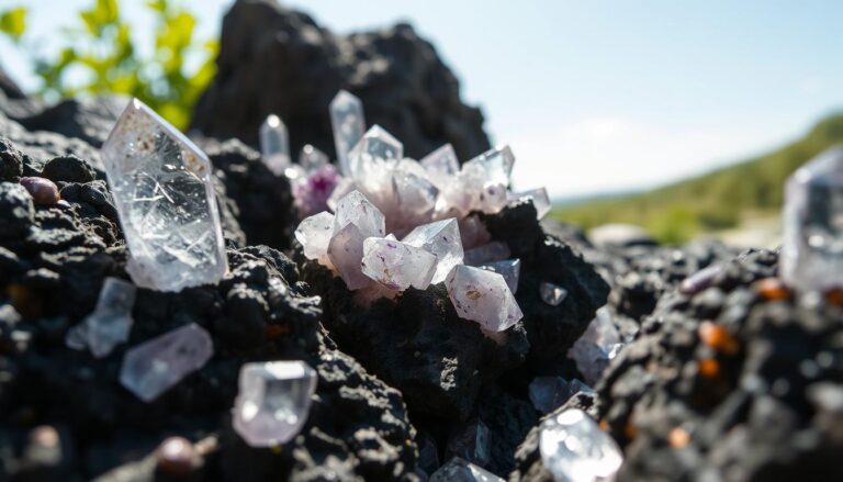
- Red and pink areas – igneous rocks like granite that often contain quartz crystals, feldspar, and mica
- Brown and orange zones – sedimentary rocks including limestone with fossils and sandstone with interesting patterns
- Green sections – metamorphic rocks that may hold garnet, schist, and other transformed minerals
- Blue areas – water bodies, but check nearby shores for water-worn specimens
- White or gray – younger sediments that rarely contain collectible specimens
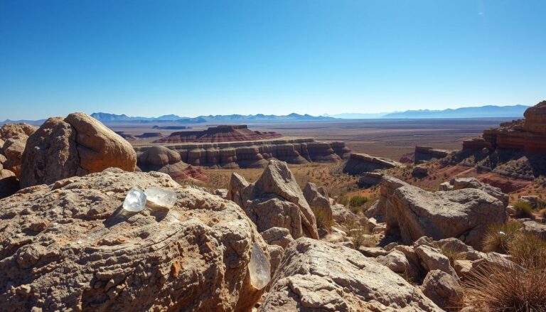
Finding the Best Collecting Areas
Contact zones where two different rock types meet create the most productive rockhounding locations. These boundary areas often produce unique minerals that formed when different rock chemistries interacted under heat and pressure.
Look for places where igneous rocks intrude into sedimentary formations, or where metamorphic zones border other rock types. These transitions zones frequently contain the most interesting and valuable specimens, which explains why certain areas produce more gems than others.
Targeting Specific Rock Types
Different rock formations yield different types of collectible materials, so match your map reading to your collecting goals. Focus your search on rock units known to produce what you want to find.
- For fossils. Target marine limestone, shale, and sandstone formations shown in tan or brown colors on the map.
- For crystals. Look for granite, pegmatite, and volcanic rock areas marked in red or pink colors.
- For agates. Focus on volcanic regions and ancient riverbeds where silica-rich solutions once flowed.
- For gemstones. Check metamorphic zones where heat and pressure created new mineral combinations.
Start With Your State Survey
Every state geological survey publishes detailed maps of local formations. Contact your state geology department for the most current maps and collecting site information specific to your area.
Using USGS and Online Resources
The United States Geological Survey provides free access to detailed geology maps through their online database. These maps cover every corner of the country and include information about rock ages, mineral content, and formation processes.
Modern digital mapping tools let you overlay geology data with topographic maps, satellite imagery, and road networks. This combination helps you plan access routes to promising areas and identify specific outcrops worth investigating. Understanding geology clues that point to hidden gems becomes much easier when you can analyze multiple data layers simultaneously.
Digital Mapping Tools
Several online platforms combine geological data with practical information for field collectors. These tools make it easier than ever to scout locations from home before heading out.
- USGS National Map Viewer – free access to all published geology maps with download options
- State geological survey websites – detailed local maps with collecting site databases
- GeoMapApp – interactive tool that combines multiple data layers for comprehensive site analysis
- Google Earth – satellite imagery that shows actual rock exposures and access roads
Planning Your Field Trips
Once you identify promising areas on geology maps, the next step involves planning practical field trips to those locations. Consider access routes, land ownership, collecting regulations, and safety factors when choosing your targets.
Cross-reference geology maps with land ownership information to avoid trespassing on private property. Many of the best collecting areas lie on public lands where collecting is permitted under specific guidelines. When scouting locations, remember that riverbeds are good for rock collecting because water naturally concentrates and exposes specimens from upstream geological formations.
Safety and Legal Considerations
Always check collecting regulations for the areas shown on your geology maps. National parks, wilderness areas, and some state lands prohibit collecting, while other public lands allow it under permit systems.
- Research land ownership – use county assessor maps to identify public vs private land
- Check collecting permits – some areas require advance permission or limit collection amounts
- Plan safe access routes – geology maps don’t show road conditions or hiking difficulty
- Inform others of your plans – remote collecting areas may have limited cell coverage
Frequently Asked Questions
Where can I get free geology maps for rockhounding?
The USGS National Map Viewer provides free access to geology maps for all 50 states. State geological surveys also publish detailed local maps available for download or purchase.
How do I read the age symbols on geology maps?
Age symbols use abbreviations like “Pz” for Paleozoic or “Tr” for Triassic. Older rocks generally contain different mineral types than younger formations, so understanding ages helps predict collecting potential.
What scale geology map works best for rockhounding?
Maps at 1:24,000 scale provide the most detail for collectors, showing individual outcrops and small formations. Larger scale maps at 1:100,000 work better for regional planning and identifying general rock types.
Can I collect rocks on all areas shown on geology maps?
No, geology maps show rock types but not land ownership or collecting restrictions. Always verify that collecting is permitted in specific areas before removing any specimens.
How accurate are geology maps for finding specific minerals?
Geology maps show rock types that typically contain certain minerals, but don’t guarantee you’ll find specific specimens. Use maps to identify promising areas, then do field reconnaissance to locate actual collecting sites.
Final Thoughts
Using Geology Maps For Rockhounding transforms random wandering into focused treasure hunting. These scientific tools reveal exactly where nature created the conditions for interesting mineral formation.
Start with your local state geological survey website this week to download maps of nearby areas. Spend time learning to read the colors and symbols before your next collecting trip, and familiarize yourself with how to read rock layers when collecting to maximize your field success.